Levels of administrative units and spatial data
Although Estonia is a small country, there are infinite ways to measure, divide and classify it. The following overview outlines the main ones that are also used to present the results of the 2021 population and housing census.
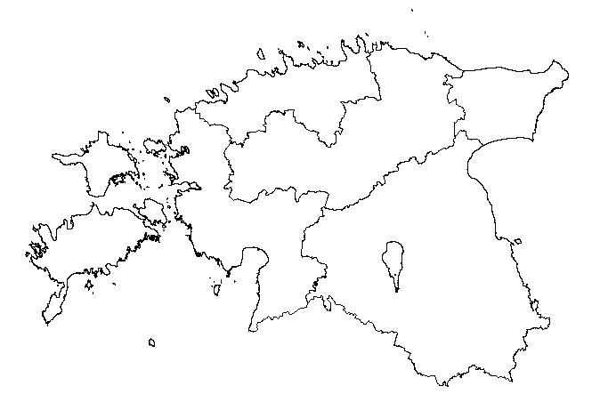
Administrative division of Estonia
The most important and most used division is the splitting of Estonia into 15 counties, which in turn are divided into 79 municipalities, and these in turn into 4,692 settlement units (as at 31.12.2021). The administrative division of the territory of Estonia is regulated by the Territory of Estonia Administrative Division Act (ETHS) and an overview of the current administrative division can be found in the Estonian Administrative and Settlement Classification (EHAK).
County, municipality, and settlement unit
There have been 15 counties in Estonia since 1991. As of 2018, there are no longer any county governments in Estonia, so a county is a territorial unit consisting of municipalities, in which state administration is carried out by the minister responsible for a particular subject field together with government agencies. Since Estonia regained its independence, the number of municipalities has been steadily decreasing and after the administrative reform of 2017, there were 79 municipalities left in Estonia: 15 cities ja 64 rural municipalities. These numbers have remained the same to this day (as at 31.12.2021). Life in rural municipalities and cities is organised by municipalities that are divided into 4,692 smaller settlement units or settlements, which can be cities, villages, towns, or small towns. The entire land territory of Estonia is divided into settlement or administrative units.
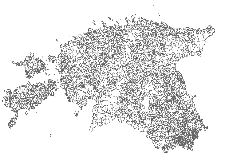
Download the spatial data file of settlements here
Administrative units
Ever since the administrative reform, it can be difficult to understand the difference between a city as an administrative unit and a city as a settlement unit. Administratively, there are 15 municipalities in Estonia that bear the name of city: Keila, Loksa, Tallinn, Kohtla-Järve, Narva, Narva-Jõesuu, Sillamäe, Paide, Haapsalu, Rakvere, Pärnu, Tartu, Viljandi, and Võru. These 15 cities are divided into two categories: cities as administrative units and cities as settlement units. Cities as administrative units are also settlements within the same boundaries, which means that there are no settlement units in these cities and the lowest administrative level is the municipality. Such cities are, for instance, Tallinn and Narva. Cities as settlement units – so-called intra-urban cities – are located within an administrative unit of the same name in which, in addition to the city, there are other settlements. An appropriate example is Tartu city, where the municipality of the city of Tartu includes Tartu city as a settlement unit, one small town, and twelve villages.
In addition to 15 cities, there are 64 rural municipalities in Estonia. There are no rural municipalities in Estonia that consist of only one settlement. There are different types of settlements in Estonian rural municipalities, including cities. Estonia has 32 cities as settlement units within a rural municipality (cities without municipal status). In addition, there are 177 small towns and 11 towns in the rural municipalities of Estonia. A rural municipality may also contain several cities without municipal status, for instance, both Kiviõli and Püssi city are in Lüganuse rural municipality.
Thus, there are 47 cities in Estonia, categorised as follows:
10 cities as administrative units
5 cities as so-called intra-urban cities
32 cities without municipal status
An overview of cities and their affiliation can be seen on the website of the Ministry of Finance.
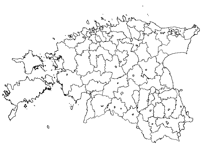
Download the spatial data file of administrative units here
Settlement (urban, small urban, rural)
In addition to the official administrative division of Estonia, there is also the concept of settlement. In the past, people were divided into urban and rural populations according to administrative units, but ever since the administrative reform, this approach is no longer sufficient. Also, there are settlements in Estonia whose name refers to a village, but which look and act like cities. For example, Järveküla, the largest village in Estonia, on the outskirts of Tallinn, has a population of nearly 3,000 people, whereas less than 700 people live in Kallaste, the smallest city. The settlement methodology used in the population census and Statistics Estonia in general divides Estonia’s settlement units into three categories: urban, small urban, and rural.
The settlement methodology entails overlaying Estonia with an imaginary 500 x 500 m grid. The resulting squares form clusters, which are divided on the basis of population size and density according to the EHAK classification mentioned above. For instance, an urban cluster is assumed to have a population of at least 5,000, with a density of more than 1,000 people per km2. A map of Estonian settlement units is superimposed on the clusters, and the dominant cluster type within the boundaries of the settlement is assigned to the settlement unit. Additional information can be found on the website of Statistics Estonia. A comprehensive overview is also available in the Address Data Manual of the Estonian Land Board (in Estonian).
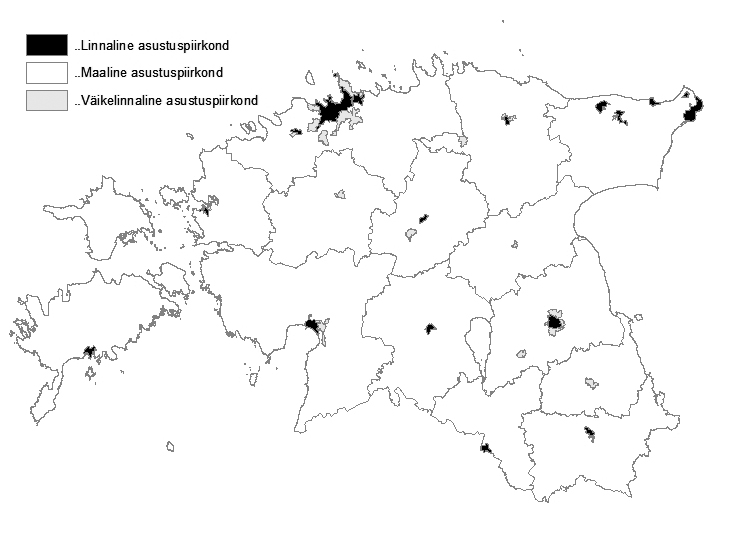
Download the spatial data file of settlements here
Built-up locality
For international comparisons, a methodology of locality is used. Nowadays, as a result of urban sprawl and other population migration processes, the boundaries between urban and rural areas have become relatively blurred. Therefore, the concept of a locality has been introduced to refer to an area that is distinct from its surroundings but has a definite settlement pattern. A locality can be a city, town, or village, but also a group of settlements that have merged (grown together). A city can be divided into several localities, if they are clearly separated, for example, by a river (in Pärnu) or a belt of parks (Pirita city district in Tallinn, Ihaste city district in Tartu). A locality is characterised by a large population size, for which a standard scale is provided. In Estonia, the following part of the scale is used:
200,000–499,999
100,000–199,000
50,000–99,999
20,000–49,999
10,000–19,999
5,000–9,999
2,000–4,999
1,000–1,999
500–999
200–499
< 200
Locality is a derived characteristic that requires the fixation of spatial coordinates of a person’s dwelling. In the 2011 census, 369 localities were identified in Estonia, accounting for 85% of the Estonian population. Read more in the 2011 population census methodology document and a news release of Statistics Estonia.
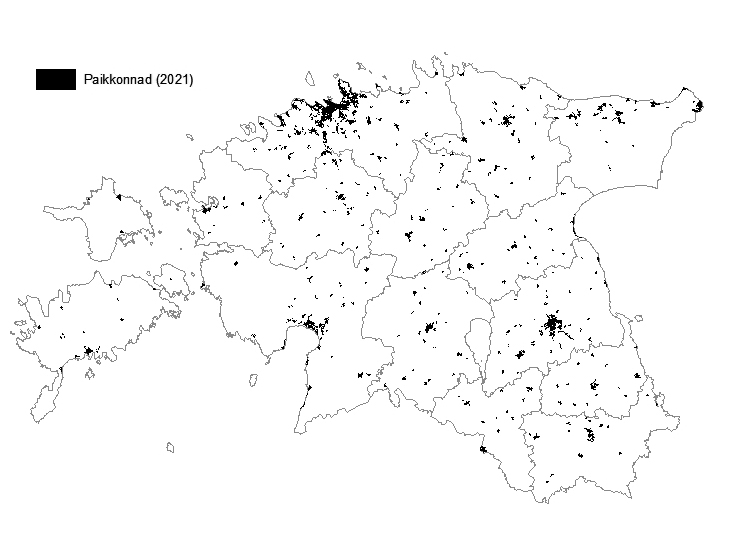
Download the spatial data file of built-up localities here
NUTS 3 nomenclature
The Nomenclature of Territorial Units for Statistics, abbreviated NUTS (from the French nomenclature d'unités territoriales statistiques), is a three-tier division system used uniformly in the European Union. Due to Estonia’s small size, we do not have NUTS levels 1 and 2. There are five NUTS 3 regions in Estonia, and these have been formed on the basis of counties. The EU standard requires the population of a NUTS 3 region to be between 150,000 and 800,000.
NUTS 3 regions in Estonia are:
Northern Estonia: Harju county
Central Estonia: Järva, Lääne-Viru, and Rapla county
North-Eastern Estonia: Ida-Viru county
Western Estonia: Hiiu, Lääne, Saare, and Pärnu county
Southern Estonia: Jõgeva, Põlva, Tartu, Valga, Viljandi, and Võru county
More information on the NUTS nomenclature is available on the website of the Statistical Office of the European Union.
Boundaries of NUTS regions can be downloaded on the on the website of Eurostat.
Download the spatial data file of NUTS 3 regions in Estonia here